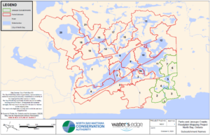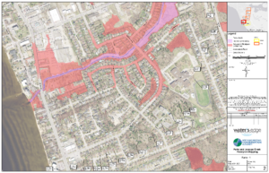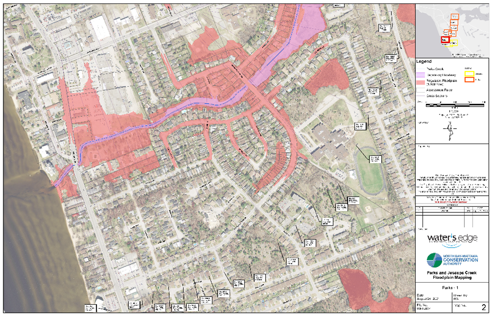
PROJECT: Park’s and Jessup’s Creeks Floodplain Mapping Project
CLIENT: North Bay-Mattawa Conservation Authority
NUMBER OF YEARS DEALING WITH CLIENT: +/- 10 years
DESCRIPTION OF PROJECT:
- Water’s Edge was authorized by North Bay-Mattawa Conservation Authority (NBMCA) to provide technical and engineering services to determine floodplain mapping of Park’s and Jessup’s Creeks in the City of North Bay.
- Water’s Edge staff processed raw LiDAR data for use in modelling and completed structure surveys on the study reaches.
- A hydrologic model was built for the watersheds using HEC HMS and a hydraulic model was built using HEC-RAS.
SERVICES PROVIDED: HEC-HMS and HEC-RAS Modeling for Floodplain Mapping
DATE OF PROJECT: Fall 2018 – 2023