PROJECT: Town of Saugeen Shores Floodplain Mapping Project
CLIENT: Saugeen Valley Conservation Authority (SVCA)
NUMBER OF YEARS DEALING WITH CLIENT: +/- 3 years
DESCRIPTION OF PROJECT:
- Water’s Edge was authorized by Saugeen Valley Conservation Authority (SVCA) to provide technical and engineering services to a new floodplain mapping of several lakeshore creeks.
- Water’s Edge staff collected LiDAR data and processed the data for hydraulic modeling and mapping uses.
- Water’s Edge staff collected bridge/culvert information.
- A hydrologic model was built for the creeks using HEC HMS.
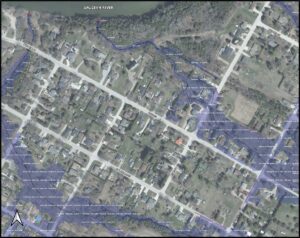
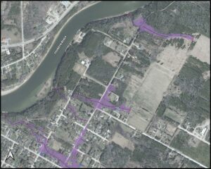
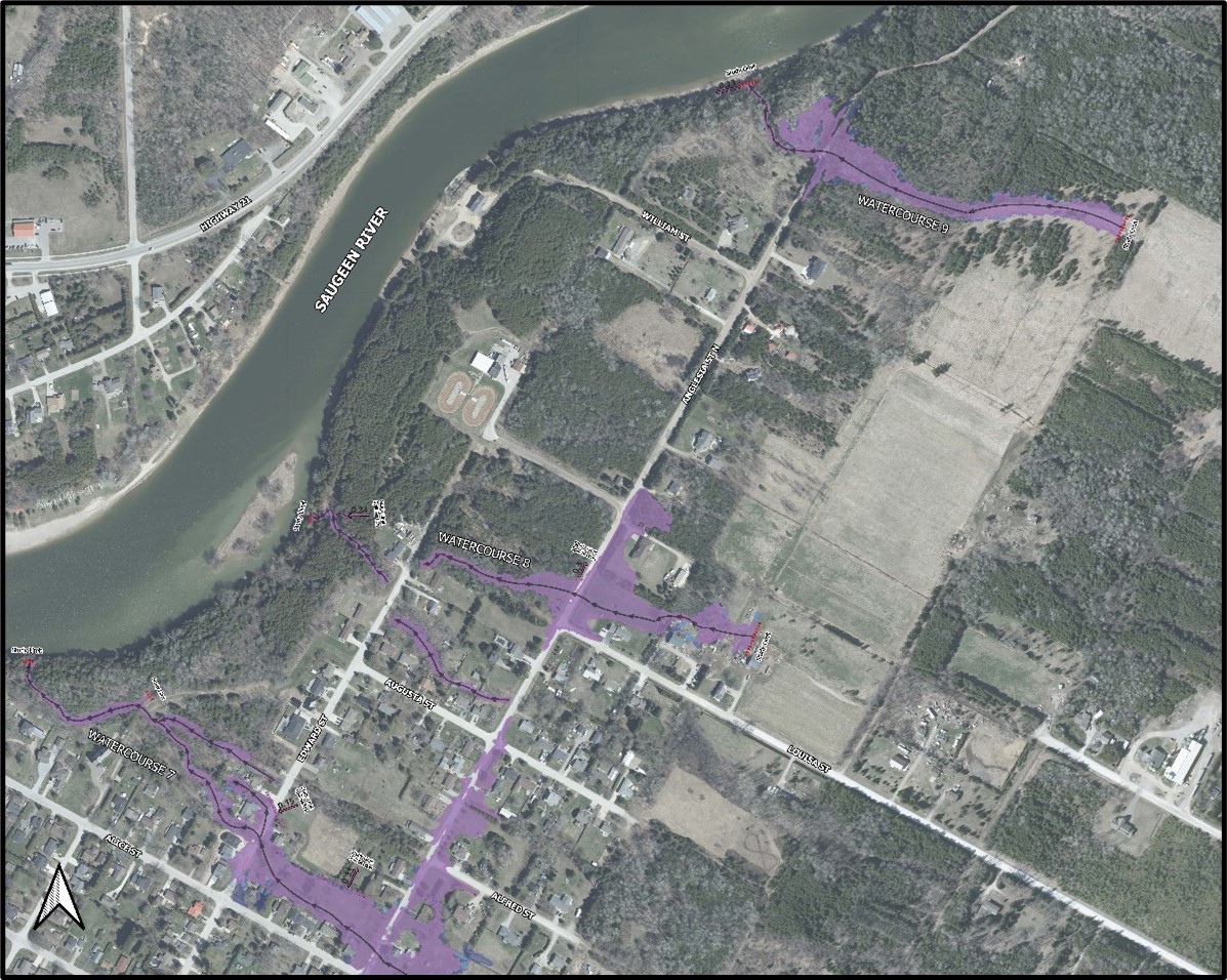
- Historical 1D modelling indicated significant spill areas in the mapping. Due to the small creek sizes and flat terrain, it was 1D modelling was deemed in appropriate for Floodplain Mapping.
- A 2D unsteady state HEC-RAS model was produced to determine the water surface elevations for the various design storms.
- Floodplain maps were then produced using the HEC-RAS results according to Provincial and Federal standards.
SERVICES PROVIDED: HEC-HMS and 2D HEC-RAS Modeling for Floodplain Mapping
DATE OF PROJECT: Spring 2023-2024