PROJECT: Township of Huron-Kinloss Floodplain Mapping Project
CLIENT: Saugeen Valley Conservation Authority (SVCA)
NUMBER OF YEARS DEALING WITH CLIENT: +/- 3 years
DESCRIPTION OF PROJECT:
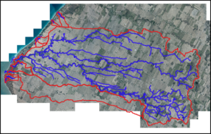
- Water’s Edge was authorized by Saugeen Valley Conservation Authority (SVCA) to provide technical and engineering services for first ever floodplain mapping of the Pine River and several lakeshore creeks.
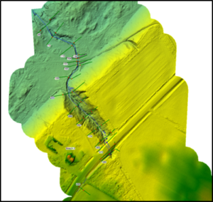
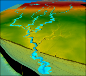
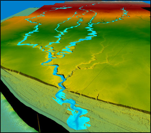
- Water’s Edge processed LiDAR and GIS layer data for hydraulic modeling and mapping uses.
- Water’s Edge staff collected bridge/culvert information useful for future databases for the CA and Municipality
- A hydrologic model was built for the creeks using HEC-HMS.
- A 1D HEC-RAS model was produced to determine the water surface elevations for the various design storms.
- Floodplain maps were then produced using the HEC-RAS results according to Provincial and Federal standards.
SERVICES PROVIDED: HEC-HMS and HEC-RAS Modeling for Floodplain Mapping
DATE OF PROJECT: Spring 2023-2024 (Models and Reports Completed in February 2024; Public Consultation ongoing).